Science & Technology | GS II
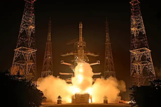
ISRO successfully launched the NVS-03 navigation satellite aboard GSLV-F18, aiming to restore the functioning of India's Navigation with Indian Constellation (NavIC) after failures of atomic clocks aboard earlier satellites affected the navigation services.
What is NavIC?
- India's independent regional satellite navigation system, developed by ISRO.
- It provides Position, Navigation, and Timing (PNT) services to users in India and the surrounding region.
- Its primary service area covers India and extends approximately 1,500 km beyond the Indian landmass.
- It was earlier known as the Indian Regional Navigation Satellite System (IRNSS).
- Applications:
What services does NavIC provide?
- Positioning: Identifies the location of a user or object.
- Navigation: Helps determine direction and plan routes.
- Timing: Provides accurate time signals for systems that depend on precise synchronisation.
NavIC supports applications such as road and marine navigation, vehicle tracking, disaster management, and timing services.
Why does India need an independent navigation system?
- Most navigation applications depend on satellite navigation systems operated by other countries.
- Depending entirely on foreign systems can create problems during international conflicts or restrictions on access to navigation signals.
- An independent system gives India greater control over navigation services used in civilian, commercial, and strategic activities.
Why did NavIC need new satellites?
NavIC faced difficulties because of failures of atomic clocks aboard some of its earlier satellites.
- Atomic clock failures: The first-generation IRNSS satellites experienced failures of their imported rubidium atomic clocks. This affected the availability of navigation signals.
- NVS-02 mission: Launched in January 2025, NVS-02 could not reach its intended orbit because of a problem in the signal supplied to the engine's oxidiser-line pyro valve during orbit raising.
- Shortage of operational satellites: NavIC had only three satellites providing Positioning, Navigation and Timing services, against the four required for basic standalone positioning.
This created a need to replenish the constellation and improve the reliability of its navigation services.
How does NVS-03 strengthen NavIC?
- NVS-03 is the third satellite in ISRO's second-generation navigation satellite series. It is designed to improve the continuity and availability of NavIC services.
- Key features:
- Adding L1 is expected to improve NavIC's compatibility with commonly used navigation devices and expand its civilian applications.
- Longer mission life
What is the significance of NVS-03 for India?
- Strategic autonomy: Reduces dependence on foreign satellite navigation systems.
- Indigenous technology: Strengthens India's ability to develop critical technologies such as atomic clocks.
- Civilian applications: The additional L1 signal can improve compatibility with commonly used navigation devices.
- Continuity of services: Helps replenish the NavIC constellation and improve service availability.
- National security: Provides an independent regional navigation capability for strategic requirements.
Conclusion:
India must strengthen indigenous navigation technologies to ensure reliable positioning services, technological self-reliance and strategic independence.